What is the "Tree City" Geo Location Project?Trees are vital to our community and Green Elk Rapids wants to help nurture our tree assets. Along with our effort to become an Arbor Day "Tree City", having an updated Tree Survey can assist our village with winning grants to support trees in our community.
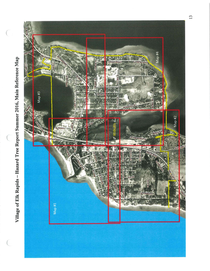
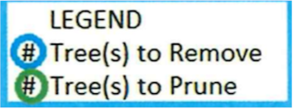
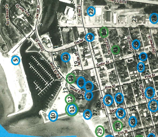
The village of Elk Rapids commissioned a tree survey in 2016 that included 4 maps of trees with estimated locations. Since then, some trees have been removed and Green Elk Rapids has started an effort for Elk Rapids to become an Arbor Day Tree City. Arbor Day "Tree Cities" support long term tree planning and budgeting. To that end, we need to update our tree map to identify trees that have been removed. As a Tree City, adding geographic longitude and latitude data to our tree map will give us an advantage when we apply for tree related grants. As an Arbor Day observation, we hope to mobilize a team of volunteers to use Google Maps on their smartphones to collect tree geo data (longitude and latitude) for the trees identified (each tree has a number shown on the maps below) Geo Locate Elk Rapids Trees for Arbor DaySaturday, April 29th, 2023
|
How to use the 2016 Tree Survey Maps
We want to update the Elk Rapids 2016 Municipal Tree survey information. Our volunteers will mobilize on April 29th to help identify which trees have been removed since 2016:
How do Volunteers 'Geo Locate' a Tree?
The Navigator -Finds the Tree
- Pick an 'Available' Tree below, note the 'Tree No' and which '2016 Map No' it's shown on
- Click on the "2016 Survey Map" above, find the "Map No" then find the "Tree No" and where it's located
- Go to the identified tree's physical location
- At the tree's physical location
- Find the 'Tree No' below, click the 'Past Geo Location for Tree' hyperlink and follow the directions to Paste Geo Location


